
ضرب زلزال مدمر مناطق عدة في جنوب تركيا، وكان كفيلاً بإحداث خسائر فادحة في الأرواح بالإضافة إلى تدمير هائل.
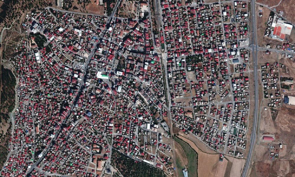
والتقطت صور الأقمار الصناعية مشاهد الدمار الواسع الذي خلفه الزلزال، أمس الاثنين، وتظهر هذه الصورة منطقة سكنية واسعة، محاطة بمناطق خضراء قبل وبعد الكارثة.
في الصورة الأولى التي التقطت في 4 شباط، أي قبل الزلزال، تظهر المنازل والمناطق الخضراء، قبل أن يحل التدمير بالمنطقة، حسبما يظهر في الصورة الثانية التي التقطت، في 7 شباط، أي غداة الزلزال، وفق خدمة “ميكسار تكنولوجييز” للأقمار الصناعية.
ونشرت الخدمة صورة متحركة تظهر فيها آثار التدمير بعد الزلزال:
Our latest images from the #earthquake in #Turkey. Weather and cloud cover have been a factor in obtaining new imagery of the affected areas. We will be releasing new imagery as we get it. Seen here is a before (Oct 4, 2022) and after (Feb 7, 2023) overview of #Islahiye, Turkey. pic.twitter.com/CAvQvjb1bZ
— Maxar Technologies (@Maxar) February 7, 2023
والأمر ذاته ينطبق على هذه الصورة لمجموعة منازل في منطقة سكنية، حيث يظهر شجر أخضر كثيف اختفى في اللقطة الثانية، وكذلك مجموعة بنايات سقطت جميعها.
We are working with multiple organizations to provide them with #satelliteimagery of the recent #earthquake that has devastated #Turkey & #Syria. Seen here are before (Oct 4, 2022) & after (Feb 7, 2023) images of #Islahiye, Turkey, showing collapsed buildings & rescue operations. pic.twitter.com/3c69oZFYmu
— Maxar Technologies (@Maxar) February 7, 2023
We will be activating our Open Data Program (https://t.co/KG4Ln7Gvck) for the powerful #earthquakes in #Turkey and #Syria. Please stay tuned for that notification. Seen here is another before (Oct 4, 2022) and after (Feb 7, 2023) view of #Islahiye, Turkey and the destruction. pic.twitter.com/jd8KakGRgb
— Maxar Technologies (@Maxar) February 7, 2023